Tag Archives: Landscape

Continued Loss of History

As part of my coursework, I looked into the ongoing issue surrounding the battle site at Prestonpans. During the last three years, the community have been involved in a number of disputes within itself regarding whether or not to continue protecting the battle site or allow it to be built over.

Part of this is a moot point as the battle site has already been built upon partially; a sportsfield and sports centre are built on one part. A major road runs through the middle of the battle site and what is left is now disputed land.

Part of the community under the leadership of the community council wish to put commerce and industry first and continue to build over what is left, stating that “No one was interested in the battle site”. This was met with complaints and a campaign by parts of the local community to protect the battle site so that history can be protected for future generations. Whilst this campaign has had limited success in preventing the destruction of local history, it was met with a lukewarm reception by the wider community. Only when the battle was featured as part of the television series “Outlander” that wider recognition of the battle and its place in history was highlighted to a wider audience.

This success, however, is now being overridden by the needs of the county council who are starting to build a new town on part of the battle site. The loss of the locale is being highlighted by local historian Arran Johnston who has said that the loss of historical evidence presented by the landscape is “like knocking down a castle”

Johnston points out the landscape changes in Wallyford, where the original battle site for the Battle of Pinkie has been completely lost due to a recent housing development which has been built over the battle site. This loss of an important piece of the landscape means that any living history of the area is no longer relevant, as it can no longer be referenced.

Personally, this saddens me, part of this course has ignited a passion for capturing the local landscape within the concept of its living links to history; to see and hear that the landscape which has remained static for so long is now undergoing a destructive change at the had of mankind. When the landscape is gone, we lose a part of the history and links to the past.

References

Sharp, M. (2016). Row brews over draft plans to build over historic battlefield. [online] East Lothian Courier. Available at: https://www.eastlothiancourier.com/news/14537253.row-brews-over-draft-plans-to-build-over-historic-battlefield/ [Accessed 10 Dec. 2019].

Smith, M. (2019). ‘It’s like knocking down a castle’: The fight to save Scotland’s battlefields. [online] HeraldScotland. Available at: https://www.heraldscotland.com/news/18063696.its-like-knocking-castle-fight-save-scotlands-battlefields/?fbclid=IwAR2ss32osxTETUAjHfRjx3qZgvAkgjhSzsrCTvLnuDLXkNZDpinKeydcWy4 [Accessed 10 Dec. 2019].

Assignment 6 Transitions -Abandoned process.

The process I was working on regarding assignment 6 Idea not just working out.

I had been working on an initial idea of a steady locked off tripod pointing at a particular landscape and videoing what was passing in front of the lens.

The resultant video would be processed in the same manner as in my learning log post Resuming the Journey. I was working on the conceptual idea of transition is not only the light passing during the day but also the transition of place and space as the earth revolves.

The first sets of videos were finally captured and ran through the algorithm to produce the first set of timeslices which could then be put into the barcode formats. However, on examination, I am finding too much of a similarity in the images and therefore they are not showing the transition even though the lighting conditions and condition of the landscape have changed as they are different times of the year.

The three Barcodes which I have produced are shown here.

Barcode Spring

Spring Early Day

Barcode Summer

Summer Stormy Day

Barcode Autumn

Autumn Fresh Day


I am now examining two other locations where there are physical transitions occurring on the landscape and will then make up my mind whether they are suitable for the brief or not.

Exercise 4.5 – Signifier and Signified

The student is asked to read ‘Rhetoric o the Image’ by Roland Barthes, whose essay contains an analysis of an image through semiotic analysis: quantifying how meaning is constructed and/or how a message is communicated. 

Barthes describes the two levels of meaning as sign and myth; where the sign is comprised of a signifier and the signified. Myth is the level of meaning where the viewers own experience and knowledge is taken into account when they read the image. 

The student is then asked to find an advert and identify the signifiers and the signified using Barthes method. 

After collecting and reviewing a number of adverts I chose ‘Trails’ by Adidas. 

Trail running shoe advert by Adidas. A man in a red top runs through a forest trail.

Trails by Adidas


Sign
Signifier  Signified 
Trail,  

open forest 

Freedom, wilderness, open and fresh air, no barriers or rules.  
Runner  Individual, health, happiness, self-reliance, healthy living, the pursuit of health and happiness. Excitement. 
Mud Trail  Non-urban, create your own path 
Running shoe with deep grips  The wearer will not slip or fall. Can go anywhere. 4×4 all terrain. 


Being dyslexic and having visual difficulties meant that reading Barthes essay was almost impossible. It took a few days just to plough through the text before having to sit down and construct an understanding of what Barthes was trying to communicate. 

Exercise 4.4 – Of Mother Nature  and Marlboro Men

The student is asked to read the essay ‘Of Mother Nature and Marlboro Men’ by Deborah Bright and then note the key points of interest and any personal reflections from the essay.

Bright’s essay was written in 1985, the midpoint in the Regan Presidency when corporate America and Reaganomics were the driving power behind the American ascendancy. The third opening of American manifest destiny was possible, the American dream, of expansion into space and leading the world into a new future. The first Manifest destiny had passed and was now a distant memory kept alive on  TV screens playing old John Ford movies and in the advertisement ego of the Marlboro man; the last stand of the cowboy in the middle of the US, along with his horse and his cigarettes, alone in what remains of the American landscape around him (usually the high plains or Arizona’s painted desert.

Bright is correct in framing the Marlboro man images as proto-political landscapes, these images are redolent of the geographical photography of O’Sullivan, Adams and Weston, all of them missing any feminine point of view or interest. After all, Landscape painting was a male-dominated domain, one which in the 17th and 18th centuries were not welcoming to women, who were thought not to be intelligent enough to understand or produce worthy landscapes. Marlboro man’s version of the American pioneer completely erases the pioneering women who successfully drove west with the wagon trains and made a substantial contribution to American life and to American history.

As was pointed out, in Andrews ‘Landscape and Western Art’, pp 166, Landscape painting, while attempting to reflect a certain amount of scientific accuracy, was also a constructed text of selected subjects. Thus, as in the case in Constable’s Hay Wain where the workers have no faces or real detail, they are background figures, happily performing their duties.  In reality, the workers in the fields were rioting due to a lack of work and income, partially due to war and partially due to the start of industrialisation and the industrial revolution which would render a vast number of these workers’ jobs as redundant. Constable did not include these social and political changes and upheaval as they were unsuitable subjects for a gentile landscape painting. Constable deliberately chose which parts of the landscape he wanted to represent and through that choice, disregarded the rest.

This very same choice was being made and driven within American Landscape photography from the 1940s onwards. With the growth of tourism, advertising was the biggest manufacturer of landscape images, ditching the landscape representation of change through human interaction and instead presenting the characteristic image of the wide-open America, a landscape which stretches on for miles, unexplored but yet ready and prepared to welcome tourists with roadside lodges and all modern amenities available.  The marketing of the male gaze of the landscape, by the same marketing men as the Marlboro man, created the idea of the ‘back to nature’ trip, where for a short period of time, people would harken back to the nostalgia of the rigours of the pioneer life, but without the danger. These trips would, of course, be captured on camera as a memory of the holiday – nature fit for human consumption.

Certainly, within this aesthetic, the landscape of America was treated as the unexplored wilderness of Ansel Adams Eden-like interpretation. Very much like Constable’s Hay Wain, the political landscape is ignored in favour of the spectacular but sanitised view of the subject. Bright in the same way, points to Szarkowski whom she suggests lifted the works of O’Sullivan and Weston out of context and repackaged them ‘as the indisputable sires’ of landscape photography.

As a counterpoint, Bright suggests that the work of the New Topographics photographers was the start of a movement of social critique within landscape photography. It was a limited movement Bright details due to a lack of understanding and expectation on what should be critiqued and how. Certainly, the 1970s was not the hotbed of social activism and revolution that we see today, and now the barricade to keep art free from ‘overt politics’ has been broken down.

Bright is correct in saying that the artist themselves influences the final image, through their own practice and perceptions, both social and political. Bright is also correct in stating that in the 1980s, there was a lack of support for Landscape created by female photographers and artists and by using methods of mass production and low costs, female artists had replicated the methods used by male marketing teams to make their work available to the larger public. Therefore, circumventing the interwoven gallery-led market for art, which has allowed them to articulate their ideas and politics through their landscape imagery.

In closing, Bright suggests that women may eventually break the idea that Landscape photography is the sole domain of white male photographers, who like the Marlboro man, are explorer, guide, hunter and preserver, solely responsible for the land. It can be seen outside of America that this is already happening with the work of Artists such as Fay Godwin, Susan Derges, and Vanessa Winship. It can be seen as Bright wanted, that breakthroughs are happening, for example, the work of Lois Connor whose use of large format platinum prints, creates exemplary monochrome landscapes of beauty. Connors imagery of Utah, South Dakota and China are as resplendent as the work of Adams or O’Sullivan, in my opinion.

References

Bright, D. (1985) ‘Of Mother Nature and Marlboro Men An Inquiry Into the Cultural Meanings of Landscape Photography’, (), pp. [Online]. Available at: http://www.deborahbright.net/PDF/Bright-Marlboro.pdf (Accessed: 1st May 2019).

Andrews, M. (1999) Landscape and Western Art, Reprint edn., Oxford: OUP.

Investopediacom. 2019. Investopedia. [Online]. [7 May 2019]. Available from: https://www.investopedia.com/terms/r/reaganomics.asp

Thebalancecom. 2019. The Balance. [Online]. [7 May 2019]. Available from: https://www.thebalance.com/reaganomics-did-it-work-would-it-today-3305569

Brendan seibel. 2018. Timeline. [Online]. [7 May 2019]. Available from: https://timeline.com/these-cowgirls-were-badass-56ccc26d3b9e

Adagecom. 1999. Adagecom. [Online]. [7 May 2019]. Available from: https://adage.com/article/special-report-the-advertising-century/marlboro-man/140170

Guggenheimorg. 2010. Guggenheim. [Online]. [7 May 2019]. Available from: https://www.guggenheim.org/arts-curriculum/topic/cowboys

Adrian shirk. 2015. The Atlantic. [Online]. [7 May 2019]. Available from: https://www.theatlantic.com/business/archive/2015/02/the-real-marlboro-man/385447/

Denverpostcom. 2007. The Denver Post. [Online]. [7 May 2019]. Available from: https://www.denverpost.com/2007/12/06/wests-dying-myth-marlboro-man/

Nytimescom. 2019. Nytimescom. [Online]. [7 May 2019]. Available from: https://www.nytimes.com/2015/02/23/magazine/jim-krantzs-wild-west.html

Danzigergallerycom. 2019. Danzigergallerycom. [Online]. [7 May 2019]. Available from: https://www.danzigergallery.com/exhibitions/susan-derges

Vanessawinshipcom. 2019. Vanessawinshipcom. [Online]. [7 May 2019]. Available from: http://www.vanessawinship.com/projects.php

Loisconnernet. 2019. Loisconnernet. [Online]. [7 May 2019]. Available from: http://www.loisconner.net/


Exercise 4.2 – The British Landscape during World War II

The student is asked to read the short extract from ‘Landscape for everyone’ taken from ‘Dream of England: Landscape, Photography and the Tourists Imagination’ by John Taylor. The student is asked to Summarise the key points of the extract along with any other observations or reflections from the text. 

The current idea of the English Landscape really starts with C.F.G Masterman, when in the introduction to E.O. Hoppes Book ‘England’ Masterman absorbed the other nations of the United Kingdom into the single concept of one country of ‘England’. Mastermans perspective of a single historical landscape and country which could be viewed as single frames; frozen moments of time, where the countryside moved from wilderness through agricultural, cultural, religious and industrial influences to its current contemporary state. 

As the country entered into 1940, the phoney war had failed, British troops were evacuated from Dunkirk and the fear of losing the war started to loom over the country. There was a genuine fear that suburban England would be invaded and occupied.  

[The Phoney War was an eight-month period at the start of World War II, during which there was only one limited military land operation on the Western Front when French troops invaded Germany’s Saar district. The Phoney period began with the declaration of war by the United Kingdom and France against Nazi Germany on 3 September 1939 and ended with the German attack on France and the Low Countries on 10 May 1940. While there was no large-scale military action by Britain and France, they did begin economic warfare and shut down German surface raiders. They created elaborate plans for numerous large-scale operations designed to swiftly and decisively cripple the German war effort. ]

Mastermans concept of an England which had been “unconquered for a thousand years” became a central column in propaganda; The imaginary ideal of the typical ‘English’ village where the close-knit community built around the village green, the village church and the squire tied itself to the landscape and therefore into the unbeatable English spirit, which would fight back and destroy any invaders. This was built upon by C. Henry Warren in ‘England is a village’ where he wrote that ‘England’s might is still in her fields… and in the end, they will triumph’. The propaganda ideal that Nazi Germany could be defeated as long as English people worked the fields and kept the dream of England alive in their hearts, hands and eyes. an idea that Orwell touched upon in his Essay ‘The Lion and the Unicorn’, Orwell wrote the essay as he prepared to shelter from a bombing raid. He expressed his opinion that Britain needed a socialist revolution and that the working class and the middle class could come together to form a classless society and through working together defeat the wealthy upper classes of Germany who funded the war.  

In reality, as part of the propaganda drive and to render any invasion impossible, the countryside was vandalised by camouflage, blackout and the removal of signs, place names, and road signs. This made journeys difficult if not impossible to any strangers to the area. The countryside became the refuge for city dwellers, evacuated children and the military, making it both welcome and bleak at the same time. 

This instability in the idea of the countryside was mainly resolved by offering wartime readers and viewers a link to the past, a sense of victory through a feeling of continuity; distilled from Masterman and Hoppes original ideal, the love of English scenery and beautiful England which became the foundation for the principles of victory.  Rather than show pictures of evacuated working-class children looking lost and forlorn in their new location, it was turned around so that it became a chance for the children to discover the beauty of the landscape for the first time. The upheaval and societal change were accommodated through the showing of images that reminded the viewer what they were protecting by fighting the war.  

Taylor points out that through the management of images and stories in the magazine ‘Picture Post’ the Ministry of Information worked hand in hand with the publishers to promote the ideology that the landscape of England was for everyone and worth defending. The landscape which in real terms was closed off to people was presented in layouts comparing the differences between the English way of life and that of life in fascist Germany. These articles were laid out as simply as possible to show everything that the British people were fighting to protect, the peaceful village life and individual freedom versus the military regime, persecution and loss of freedom and identity in the war machine. These presentations showed that every class had something to lose and therefore by forgetting class differences and working together to protect the English landscape they would be victorious.  

Throughout the extract, Taylor refers to the homogenous idea of England, which is interchangeable with Britain, a unified national heritage which really started in the 17th century with Francophile propaganda. The English heritage a prize which sets the British apart from everyone else, it is now part of the populist and underdog culture, caring for what is unique in their heritage, what is special to them, which is unknowable and untenable by outsiders. 

I am not sure I am comfortable with the idea of the British part being monolithic and uniform, it is too close to the Norman Tebbit cricket test where consensus is not only demanded and forced, it is taken for granted. It is too much of a central bias, which pretty much ignores any outlying country, state or region, a normative idea of a nationial being only English.  

References

Taylor. J (1994) A Dream of England: Landscape, Photography and the Tourists Imagination, United Kingdom: Manchester University Press.

Orwell. G (1976) The Lion and the Unicorn, : Ams Pr Inc..

Mischi, Julian. (2009). Englishness and the Countryside How British Rural Studies Address the Issue of National Identity.


Assignment 3 – Spaces to Places.

Brief

In Assignment 3, we are asked to explore a landscape or small part of a landscape to which there is some form of significance. The main objective of the assignments is to question how a “place” becomes as “space” and show how the idea of a place is formed by external pressures or associations. 

Recently I have been involved in a number of discussions regarding the history of the UK and history within Scotland in general. These discussions have been driven by a number of news items where developers or businesses have started to bury and destroy historic areas of interest.  

In the majority of these cases, this reflects what has already happened in parts of East Lothian and the Borders where history has been destroyed in favour of development of the land. 

In this case, I wanted to focus on the missing history of Haddington. Recently Haddington celebrated 700 years – a celebration around the signing of a town charter by Robert the Bruce. When I started to look into the historical landscape of Haddington, what I started to find were a number of bare patches. 

I decided to research and photograph the historical landscape around the siege of Haddington.  

Research 

What I quickly found was that most of 16th Century Haddington was covered over and redeveloped in the 18th Century by the Victorians as they remade Haddington into a Market town and rural holiday spot, leaving very little of any historical value behind. 

What remains of the siege walls, earthworks and boundaries of the town within have either disappeared completely or were reinterpreted by the Victorians as part history, part, folly, part garden structure. 

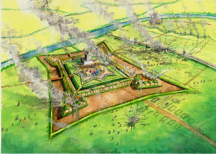
During the 16th century siege of Haddington, the town was surrounded and walled in for the duration of the siege. The English army held Haddington through the siege for 18 months. 

Process 

During the siege, hundreds were killed, but little is seen of the town as it was then. Having been recreated in the market town image of the 18th century, 16th Century Haddington appears to have been wiped clean from the map. Little is said about the siege, the brave soldiers on either side nor what happened to the town during the siege. 

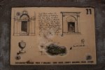
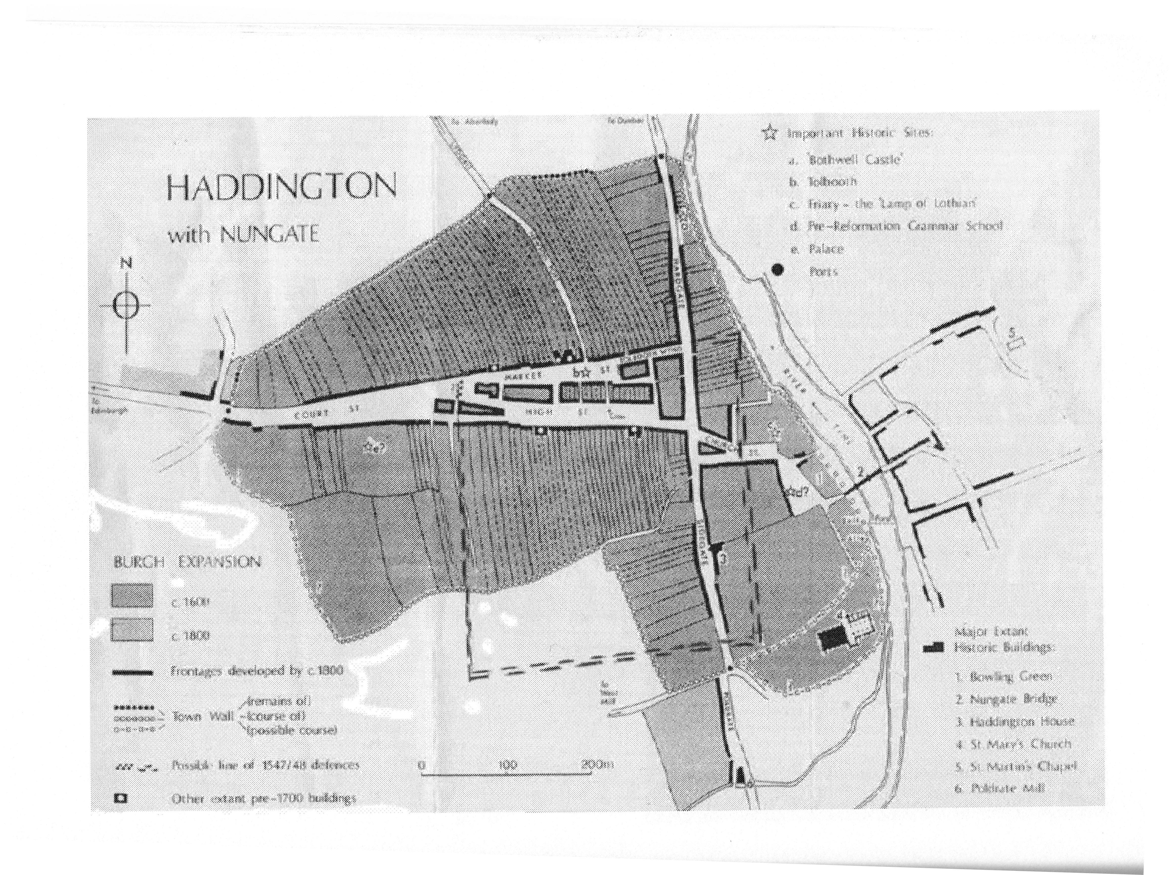
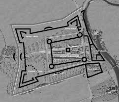
Having found the map in the book ‘Feat of Arms’ (Unwin, G. 2014), I overlaid and then marked out a rough rectangle within which the siege walls and boundaries lay. My idea is to work within the rectangle and using both google maps and physical survey work out where this large piece of history disappeared to. 

Overlaid map showing location of siege walls and earthworks over newer google map

Google map showing square around town centre

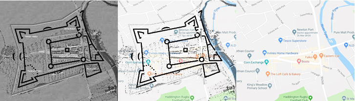
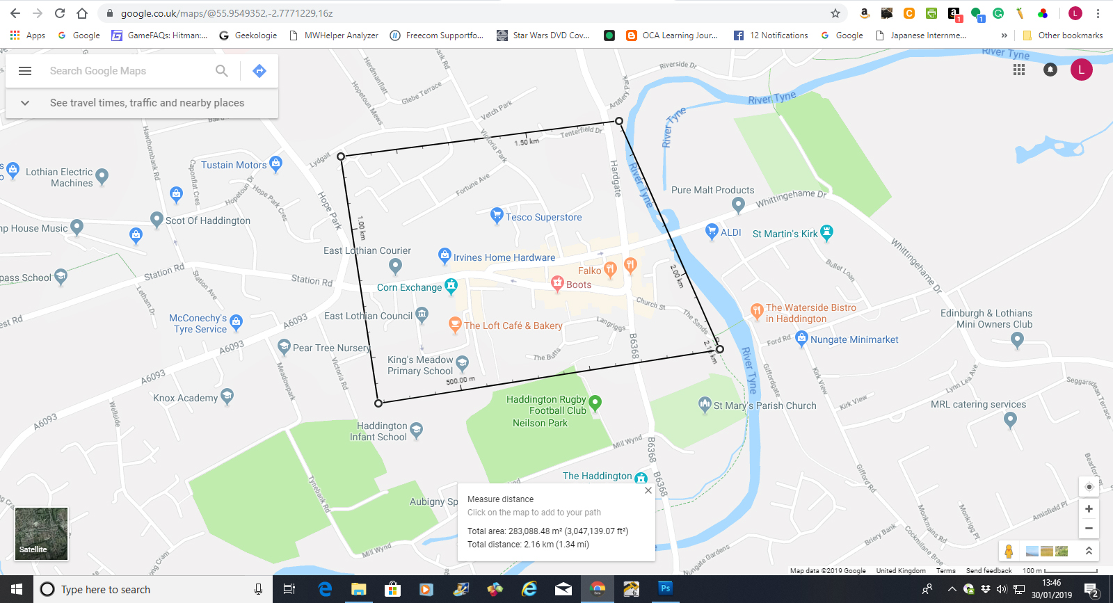
Certainly, as can be seen from the google map diagram the current town still lies within the main traffic routes, the north gates and the west gates are easy to locate within the structure of the town. Looking deeper I could find little on display to show what still existed. 

For the most part, what remains of 16th Century Haddington are place or street names; The Butts, Langriggs, Sidegate, Hardgate, Mill Wynd. 

However, due to the Victorian penchant for repurposing, small parts of the original town and walls can still be seen, if not in the same shape or location, but in style. 

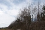
One of the few untouched areas is to the East of Haddington, where at one-point cannons had been dug into a mound, to allow the cannons to reach within the confines of the besieged area. This one important archaeological artefact remains relatively unexamined and left to nature. It was only by accident that it was rediscovered as part of this article. 

Using google maps I reviewed a number of areas within Haddington that I wanted to visit and possibly photograph; this method of survey was quite helpful to me as it allowed me to manage my chronic pain and fatigue on the days when I was at these locations, moving about and capturing images of what I could see. 

There was a delay between the online survey, the physical visit and actual photographing of the locations due to a number of issues. First of all was my own health, due to the cold weather, I was stuck inside as being out in the cold brought on my Costochondritis which makes breathing very difficult. Secondly, since I can no longer drive, I had to rely on the kindness of others when I wanted to go visit some of the locations to review them. Thirdly, my main source of transport is my wife, who having injured herself, could not walk or drive for almost six weeks. Again, I was stuck in the house unable to get to the locations. 

During this time, I started to look over the work of other artists who suffer from failing eyesight or visual impairment. The RNIB website was in itself very helpful and pointed me to a number of projects, one of which is a collection of portraits by Roy Nachum. Together with the work of Chris Friel in the collections, Silver and October, I started to review and reassess what I have been doing. 

Using the ideas of Text in the style of Ed Ruscha, but combining it with the influences from Nachum and Friel, I decided to restart the assignment and return to the exploration of my visual impairment, my continuing loss of vision, the loss of mobility and at the same time the loss of history due to progress and lack of foresight. 

Returning to the original reports and letters written during the siege, I hit upon the idea of taking direct quotes from the reports from (Lawson, John. P. 1893) and the Hamilton Papers (Bain, E. 1890) and overlaying them into the landscape images. I then went further by converting the quoted text into braille.  

Taking the converted text, I positioned it into the landscape in such a way as to interrupt the flow of the image, in the same manner, that my eye condition interrupts my day to day vision. By using braille, I further push the viewer into the uncomfortable position of not knowing what is being said.  

Images 

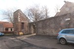
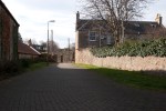
Rebuilt Walls Marys tower

Victorian recreation of siege wall and tower. Quote taken from historical figure shown in Braille
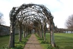
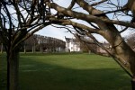
Here at the Eastern edge of what would have been one of the boundary walls, now stands a tower and two sides of a wall enclosing a small garden. The tower and walls were recreated by the Victorians to emulate the history of the town. 

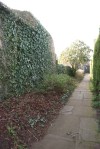
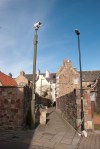
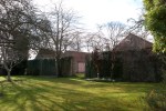
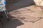
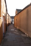
Vennel, formerly a close. 

Orange walls of a close. Quote taken from historical figure shown in BrailleThere are very few locations within Haddington where you can still get the idea of how close together the houses were built and what both the soldiers and visiting queen would have seen. Within the confines of the besieges town, there was starvation, squalor, and disease. 

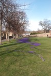
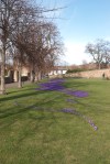
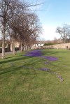
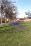
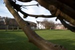
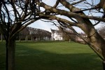
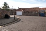
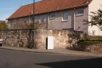
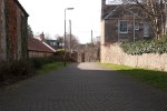
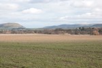
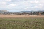
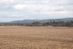
Langriggs, Current lay of the land

New housing but with fridge and cooker abandoned in the street. Quote taken from historical figure shown in BrailleDown at this end of the town, people would have gathered their livestock together for safety within one of the longer inside dividing walls. Although pieces of stone from the 16th and 17th Century are embedded in the wall, history is still regarded as passé. 

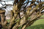
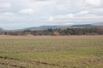
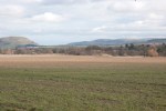
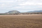
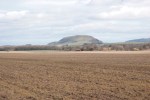
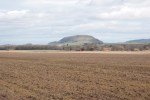
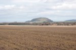
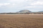
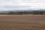
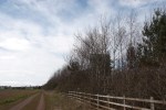
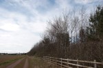
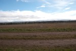
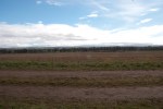
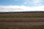
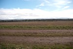
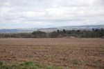
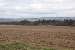
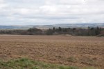
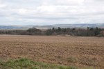
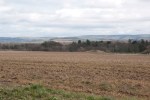
Cannon Mound, They planted a great many guns. 

Farmed field with mound of earth. Mound was cannon platfrom. Quote taken from historical figure shown in Braille
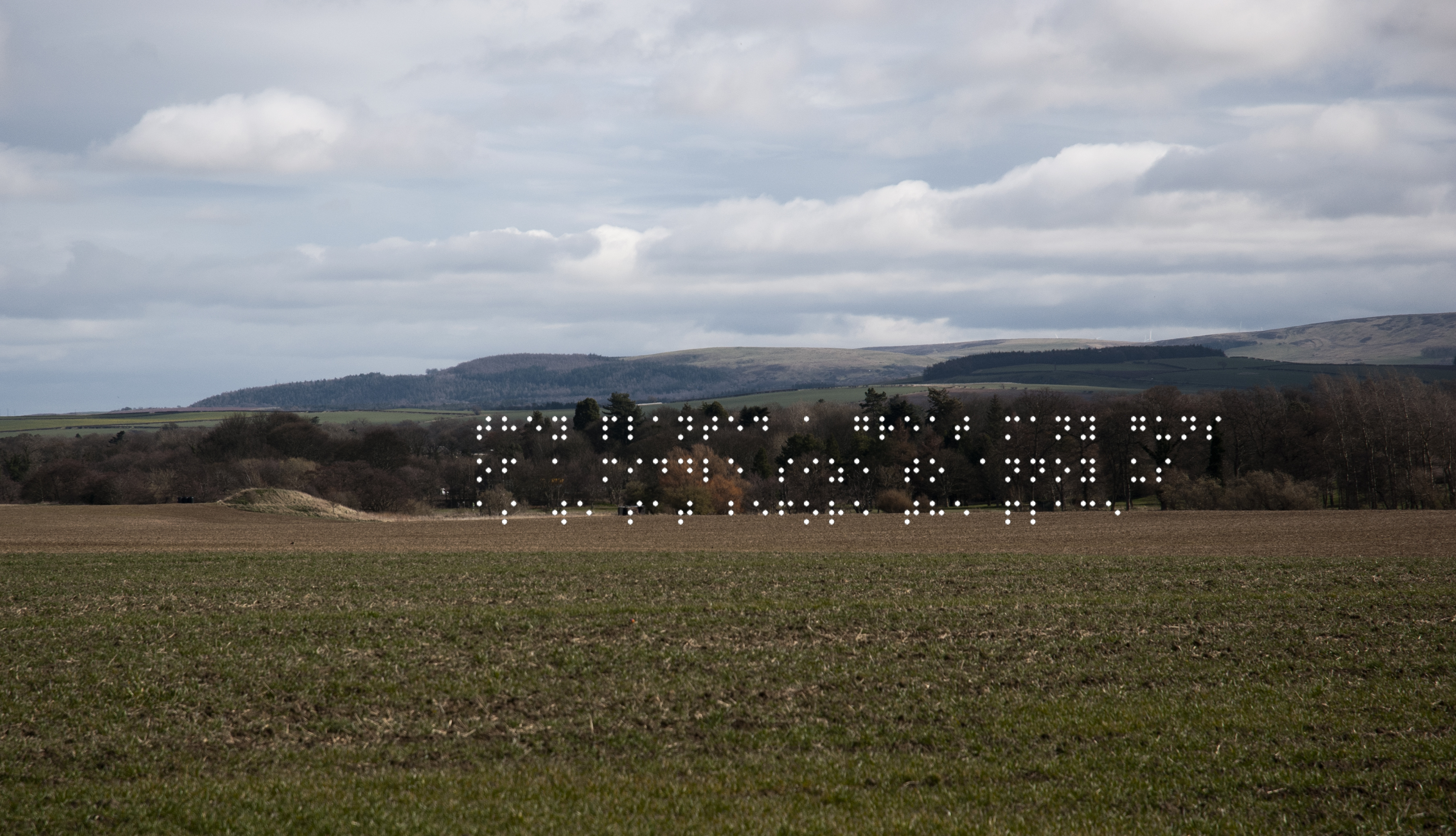
Undeclared at the edge of a working field, sits one of the few remaining cannon platforms. Last archaeologically investigated in the 1980s, it now rests disregarded and unknown. 

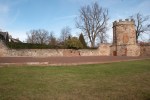
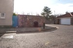
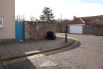
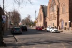
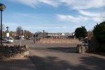
West gate, now part of court street (18th-century development)

Modern Haddington West crossroad. Quote taken from historical figure shown in BrailleWhere the West Gate would have sat, many battles were fought over this opening and where Highlanders ducked the cannon fire.  Now a major junction into the main street of the remodelled market town. 

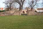
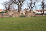
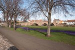
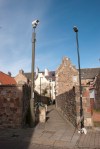
Nungate bridge leading to now derelict Abbey 

Nungate bridge over the river Tyne. Purple flowers in the foreground. Quote taken from historical figure shown in Braille
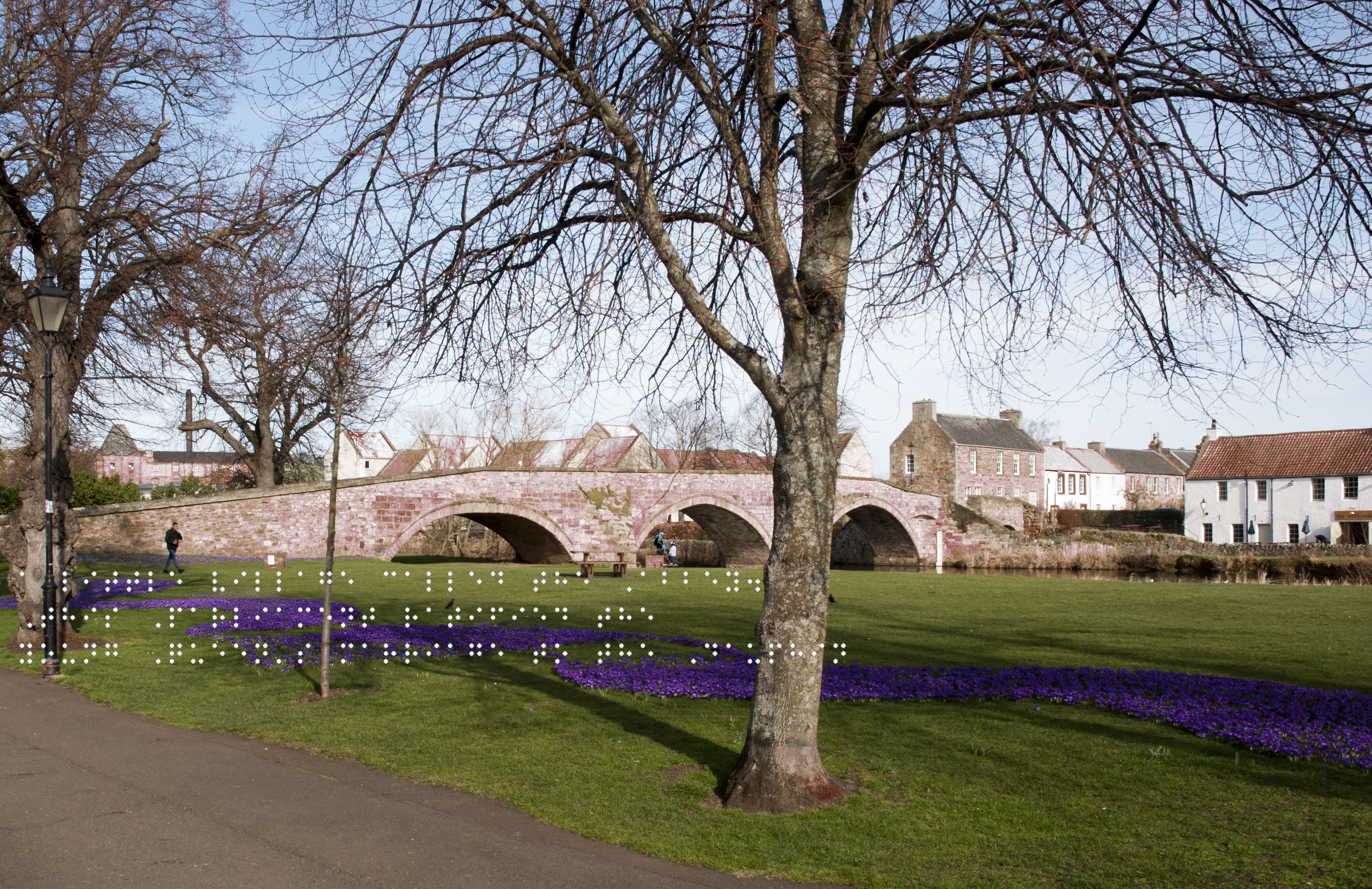
The crossing which took troops and royalty back and forth to the south. The Abbey was a designated neutral ground where a meeting between the sides could take place. 

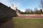
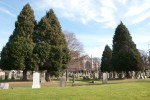
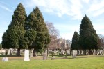
St Marys, battle-scarred but still standing. 

Foreground graveyard. Behind the trees is St Marys Church, all under a blue sky. Quote taken from historical figure shown in Braille
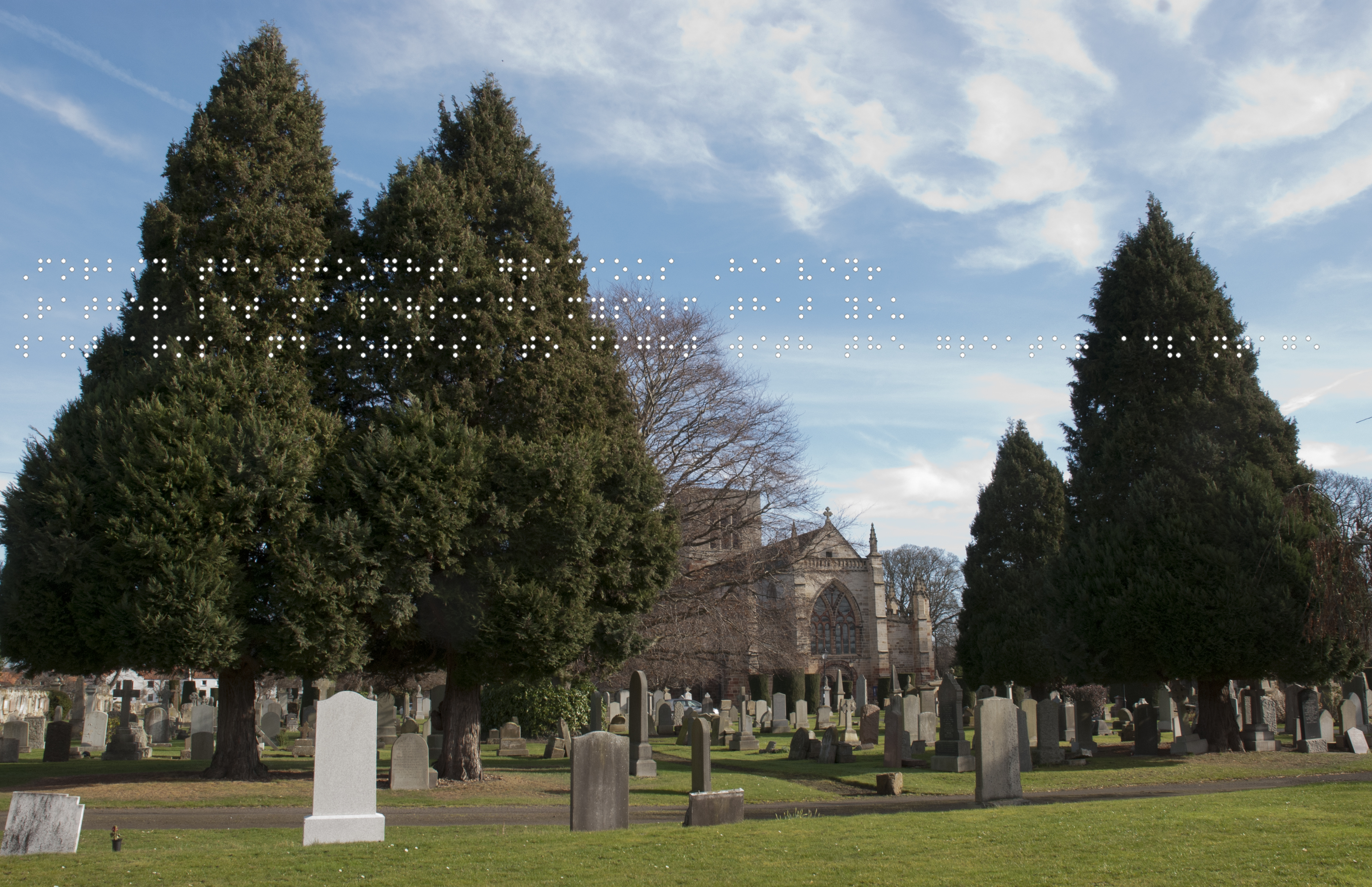
Sited outside the walls, the battles and siege did not pass this church by. While it was also a neutral space, It bears the scars of musket fire on its stone.  

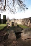
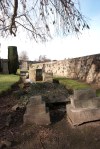
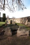
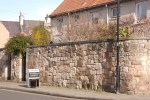
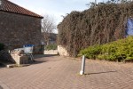
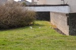
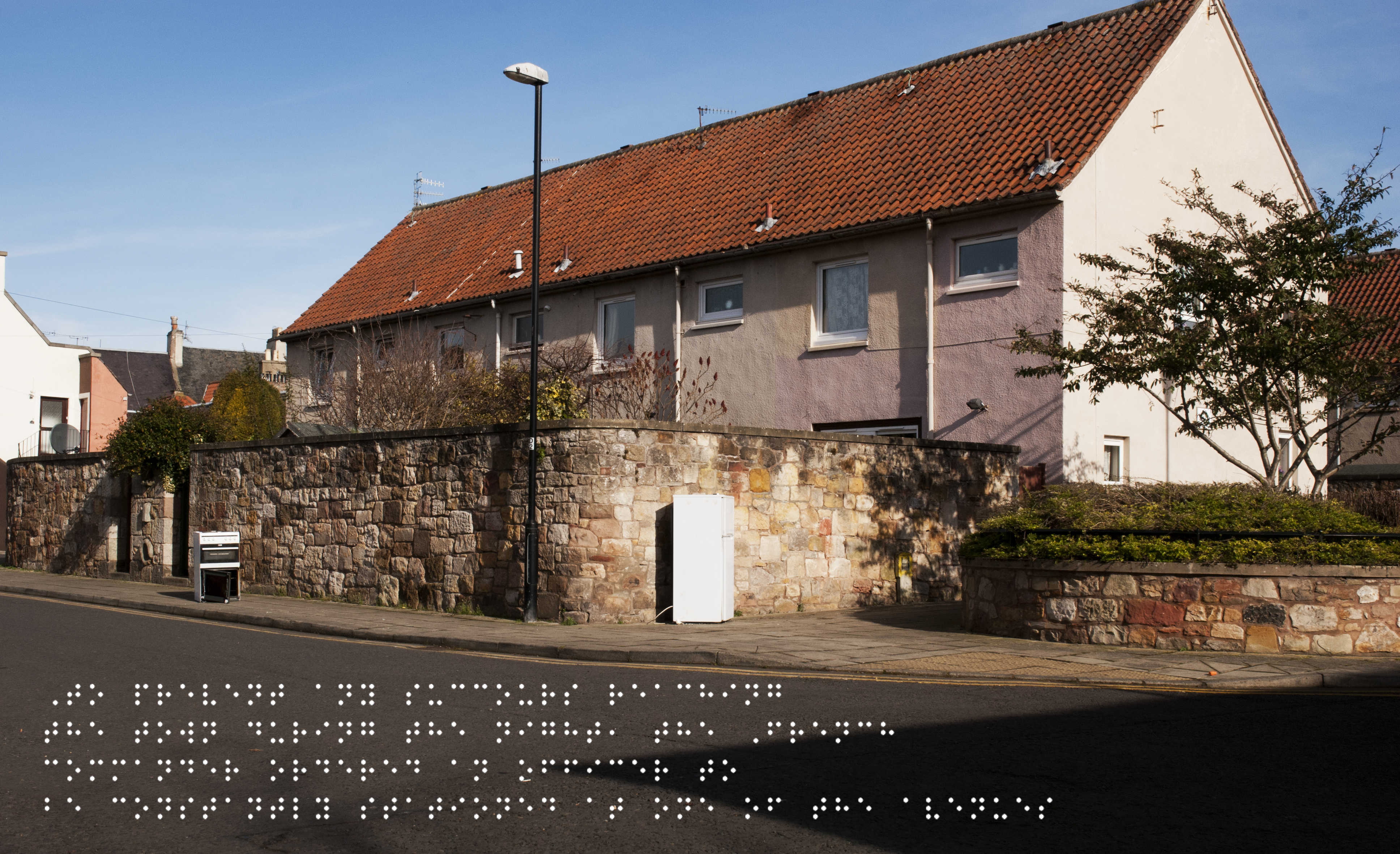
Original wall, an inner boundary 

Bailey wall, now separating houses from a green space. Quote taken from historical figure shown in BrailleAn inner bailey wall, now separating parts of sheltered housing.  
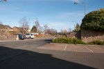
Tesco Car Park 

Empty Tesco carpark. Quote taken from historical figure shown in BrailleWhere the main part of the besieged town once sat, now resting beneath the tarmac of a Tesco carpark. Nowadays, food is more plentiful and accessible. 

Doocot, Source of food and communication. 

Jacobean dovecot. Boarded up and abandoned. Quote taken from historical figure shown in BrailleDoves and pigeons were a good source of protein, a Jacobean doocot like this would have kept a well-off family fed through the winter months of the siege. Now sealed and unattended, left for decoration and a nod to history. 

Contact Sheet 

Full set of images taken for the Assignment. Including the original braille conversion files and screenshots showing the text to Braille conversion.  


Contact Sheet for Braille Conversions.


Contact Sheet of Screenshots of the Text to Braille Conversion


Technical Choices. 

As in Assignment 1, the images were taken either handheld or supported by a crutch used as an improvised monopod. I decided to apply filters in post-production, I chose Black and White versions of the images and used them as a layer to either show highlights or shadows where possible, without making the final scene too dark or overblown.   

Conclusion. 

In the beginning I flipped between several ideas and projects, each one had its merits but in the end, the assignment was led by the research. The research itself was very enjoyable as it allowed me to dip into my fascination with local history and start discussions on why so little of it is being preserved in the county.  

Hitting on Friel and Nachum was a bit of a game changer for me; it returned me to the exploration of my condition and how it influences what I see and how I see it. The final iteration of this assignment for submission will be printed where the braille dots are raised to allow participation by a visually impaired individual as they will be able to touch the display card and get the image description and relevant information before touching the image and feeling the quote. 

References 

artNet (2017) Ed Ruscha , Available at: http://www.artnet.com/artists/ed-ruscha/ (Accessed: 19th March 2019). 

Arts Council England (2019) Disability Arts Online, Available at: http://disabilityarts.online/ (Accessed: 15th March 2019). 
 
Bain, J. (1890) The Hamilton papers. Letters and papers illustrating the political relations of England and Scotland in the XVIth century. The Hamilton papers. Letters and papers illustrating the political relations of England and Scotland in the XVIth century [Online]. Available at: https://archive.org/details/cu31924091786032/page/n6 (Accessed: 18th March 2019). 
 
Campsie, A (2018) Public inquiry called for Battle of Killiecrankie road plan Read more at: https://www.scotsman.com/lifestyle/public-inquiry-called-for-battle-of-killiecrankie-road-plan-1-4736078, Available at: https://www.scotsman.com/lifestyle/public-inquiry-called-for-battle-of-killiecrankie-road-plan-1-4736078 (Accessed: 17th March 2019). 

Campsie, A. (2019) Row as businessman ‘builds fence across Antonine Wall’ Read more at: https://www.scotsman.com/lifestyle/row-as-businessman-builds-fence-across-antonine-wall-1-4867670, Available at: https://www.scotsman.com/lifestyle/row-as-businessman-builds-fence-across-antonine-wall-1-4867670 (Accessed: 17th March 2019). 
DPS (2019) Disabled Photographers Society, Available at: https://www.the-dps.co.uk/ (Accessed: 18th March 2019). 

East Lothian Council (2019) Haddington 700, Available at: https://www.johngraycentre.org/haddington700/ (Accessed: 15th March 2019). 
Friel,C. (2019) Index/Gallery, Available at: https://www.cfriel.com/index (Accessed: 17th March 2019). 

Magdalena Szubielska (2018) People with sight impairment in the world of visual arts: does it make any sense?, Disability & Society, 33:9, 1533-1538, DOI: 10.1080/09687599.2018.1480261 

McKenna, K (2018) Second battle of Culloden rages as locals clash with developers, Available at: https://www.theguardian.com/uk-news/2018/sep/30/culloden-moor-battle-luxury-homes (Accessed: 17th March 2019). 
 
Parker Lawson,J. (2017) Historical Tales of the Wars of Scotland, Available at: https://www.electricscotland.com/history/wars/33siegeofhaddington1548.pdf (Accessed: 18th March 2019). 
 
RNIB (2017) Blind artist launches ‘ genuinely audio-visual art’ exhibit in aid of Talking Books, Available at: https://www.rnib.org.uk/blind-artist-launches-genuinely-audio-visual-art-exhibit-aid-talking-books (Accessed: 19th March 2019). 
 
Spikerog SAS (2019) Braille Translator , Available at: https://www.brailletranslator.org/ (Accessed: 20th March 2019). 
TATE (2017) Landscape, Available at: https://www.tate.org.uk/node/294527_ (Accessed: 15th March 2019). 
 
Tudor Chronicles (2015) Siege of Haddington, Available at: https://thetudorchronicles.wordpress.com/tag/siege-of-haddington/ (Accessed: 15th March 2019). 
 
Unwin, G. (2014) Feat of Arms – The Siege of Haddington, 1st edn., United Kingdom: Creative Independent Publishing. 
 
Voyatzis,C. (2012) Visual Art for the Visually Impaired by Roy Nachum, Available at: https://www.yatzer.com/visual-art-visually-impaired-roy-nachum (Accessed: 17th March 2019). 


Exercise 3.5 – Local History

The exercise as that we take at least half a day to perform historical research on the local area and produce a list of research points. It also asks how this research could be used to produce some scenes of the local landscape linking it to the local history.

The Local History of Haddington

The county of East Lothian has for centuries been an area of dispute between different factions; it has been fought over, captured and defended by armies from many different countries and factions.

Splitting down the history into sections of East Lothian has meant that I have been able to distil different historical, political, industrial and social events down into bullet points.

In no historical order.

  • Stone Age Encampment
  • Roman fortifications
  • Rough Wooing
  • Cromwell and the English Civil War
  • Jacobite Revolution
  • Coal Mining
  • Fishing
  • Salt Panning
  • Religious Retreats
  • Lighter than air craft
  • WW2 airfields for Fighters and Bombers
  • Integration of people following Glasgow Slum Clearances
  • Lowland Clearances
  • Late 1980s loss of Industry
  • Greenbelt development for Commuter villages

Using the local library online services and the online databases of the John Grey Centre I was able to refine my search to the locale of Haddington. I found quite a few smaller events, but decided on one event which is understood by some of the residents but not all; this event is the siege of Haddington which happened as part of the rough wooing. A period of turmoil where political alliances were being made through marriage; Henry VIII wanted to align Scotland and England through the marriage to his son Edward II to Mary I of Scotland, to force the situation in his favour Henry VIII attacked Scotland in an attempt to break the “Auld Alliance” with France.

After a number of bloody battles, including the disastrous battle of Pinkie, much of Southern Scotland was under occupation by English Forces. Scottish forces won and then lost Haddington to Francis Talbot, 5th Earl of Shrewsbury. During the successful defence of Haddington, the English commander Sir James Wilford had a number of earthwork platforms created as positions form his cannons.

Colour drawing concept of Haddington Siege Walls

After the siege ended, a number of the earthworks were felled, and the rest left to history. Many were lost in the following expansion of Haddington through the 18th, 19th and 20th century, but it appears as part of my research I may have found one of the last cannon platforms in a field not far from where I reside.

I have started to verify the locations using the old documents as well as the against the archaeological records from the John Grey centre and then visit the locale and photograph it.

The rest of the area of old Haddington can still be found in the seams of the new town. Currently, there are only two photographs regarding the siege and neither cover the actual area. Using the map contained within the book ‘Feat of Arms, The siege of Haddington’  (Unwin.G pp40) I have started plan to scout out the landscape both within the original town boundaries as per the barricades and the outlining areas where not only the cannons were located but also plotting and examining the locations, shown in this image where the fortification plan is overlain the area of the town as mapped in around 1590


Map of haddington showing siege locations

top down overlayhaddington


The route should take me around the church which has stone scars from the battles and past the west side of the town where the Highlanders were repelled and their encampment where they laid siege to the town for just over a year until the siege ended and the English withdrew to Berwick Upon Tweed.

I want to be able to capture not only the town within the town by showing how the landscape has been moulded by man and which has removed a number of historic developments and events from said landscape.


Harvard References

Explore the Map. 2018. Explore the Map. [ONLINE] Available at: http://www.johngraycentre.org/map/. [Accessed 12 November 2018].

John Gray Centre. 2018. You searched for – John Gray Centre. [ONLINE] Available at: http://www.johngraycentre.org/collections/getrecord/ELHER_MEL9227/. [Accessed 12 November 2018].

Grid Reference Finder | Ordnance Survey Map. 2018. Grid Reference Finder | Ordnance Survey Map. [ONLINE] Available at: https://gridreferencefinder.com/os.php?x=352925&y=674512<=55.961303&lg=-2.7556060. [Accessed 12 November 2018].

Haddington, Town Defences | Canmore. 2018. Haddington, Town Defences | Canmore. [ONLINE] Available at: https://canmore.org.uk/site/56532/haddington-town-defences. [Accessed 12 November 2018].

Siege of Haddington 1548 – English Earth and Timber Fortress. 2018. Siege of Haddington 1548 – English Earth and Timber Fortress. [ONLINE] Available at: http://www.maybole.org/history/battles/Siege%20of%20Haddington%201548.htm. [Accessed 12 November 2018].

Explore georeferenced maps – Map images – National Library of Scotland. 2018. Explore georeferenced maps – Map images – National Library of Scotland. [ONLINE] Available at: https://maps.nls.uk/geo/explore/#zoom=16&lat=55.9595&lon=-2.7706&layers=5&b=1. [Accessed 12 November 2018].

John Gray Centre. 2018.[ONLINE] Available at: http://www.johngraycentre.org/collections/getrecord/ELHER_MEL9227/. [Accessed 12 November 2018].

View: Haddington – Great Reform Act Plans and Reports, 1832. 2018. View: Haddington – Great Reform Act Plans and Reports, 1832. [ONLINE] Available at: https://maps.nls.uk/view/74491854. [Accessed 12 November 2018].

View: Plan of Haddington and Nungate. – Town Plans by John Wood. 2018. View: Plan of Haddington and Nungate. – Town Plans by John Wood. [ONLINE] Available at: https://maps.nls.uk/view/74400034. [Accessed 12 November 2018].

Gerald, M., 2014. Feat Of Arms: The Siege Of Haddington. Createspace Independent Publishing Platform.

Jon Cooper (2009) What’s Missing Here? Homing in on Haddington’s Lost Defences, Journal of Conflict Archaeology, 5:1, 141-162,


Exercise 3.4 – Persuasive Image

Part 1

The exercise asks the student to find three examples of landscape photographs that are being used to assert a particular ideological point of view. Describe how the image communicates its intended message.

Lungs

wwf_lungs

Before it’s too late, WWF France (2008) TBWA\Paris

WWF France presents a clear visual image which presents the viewpoint of the importance of trees to the atmosphere. Here WWF has brought together two clear representations on the idea of clean air, one where trees produce oxygen that we as part of the second representation, as humans our lungs use the oxygen allowing us to survive. By presenting a green landscape where the trees have been planted into groves in the shape of lungs which have now been scarred by logging. The clean graphic design elements and semiotics make the communication is clear here, we need oxygen from the trees without the trees, we cannot fill our lungs.

The graphic advertisement above, ‘Before it’s too late’, elaborately demonstrates how visual manipulation through graphic design invokes emotional manipulation through semiotics, through the use of an image similar to the ones used to prevent smoking.

Wyoming

Wyoming by BVK ad agency - manifest destiny reflection

The original open country, BVK Advertising Agency, Wyoming Tourist Board (2016)

Harking back to the early age of America and to the early age of photography, this image shows the state of Wyoming as the land in the same state as photographed by Watkins and O’Sullivan. America as Manifest Destiny.

The photographer has used the Adams zone system to create a countryside which, although mountainous and grey, has been granted a golden sheen by the sunrise burning through the morning mist. The figures in the foreground are placed slightly off to the left, again harking back to the composition idea in a landscape scene that a figure or shape can be placed in the foreground to give a sense of scale.

Glenfinnan Monument

Landscape Advertising - Glenfinnan Monument - NTS

Glenfinnan Monument, Visit Scotland

By placing the road leading to the monument in the bottom middle of the scene, the photographer forces the eye up the line and into the main body of the scene. The landscape is presented in a format resplendently similar to the landscapes of Turner and Cozens, tame and peaceful, ideologically conquered by man and for the most part unadapted by man. The loch mirrors the sky and flows off into the blue-grey distance bordered by the mountains. It presents the idea of a land welcoming and peaceful, wide vista unspoiled and untouched.

In the foreground is the monument, the statutes gaze off into the peaceful lands, in contradiction to what the monument is representing, which is the Jacobite highlander who died fighting the cause but who was then driven out of the land to go overseas so that the new landlords could farm sheep in the lands formerly owned by the Jacobean clans, which was done as part of the highland clearances in the name of progress and modern land management.


Part 2

Consider an issue that you feel strongly about. Design an image that you think will have a persuasive effect upon the viewer.

The issue that I chose is one which many in the local area feel strongly about. A member of a local council has declared that no one is interested in the remains of a Jacobean battlefield and that a large industrial park should be built on the land.

Landscape format image, green fields separated by a path running off into the distance. In the foreground stands a small monument dedicated to the dead buried on the battlefield (for that it is what the green fields are) In the mid-distance two slightly shadowy faint figures stand heads bowed before a cross. The crosses are transparent and are multiples, spread across the fields, representing the dead. In the back of the image, bulldozers rip up the land, pushing over distant crosses while two large industrial cranes tower over the fields.

Banner in the top left of the image, History should be forever, not until politicians forget.


Exercise 3.1 – Reflecting on the Picturesque

Having found that the link provided in the course text is no longer available, I used Google, JSTOR, and Archive.org to provide some relevant information.

The picturesque movement gained traction during the years where hedonistic travelers moved by their own curiosity to explore other countries. Authors lead by Gilpin, wrote in a style to convey geographical knowledge gained when traveling, where they could select in advance the places and locations which were worth seeing and reflecting upon. Gilpin especially when writing in his book ‘Observations on the River Wye’ (Gilpin, 1782) viewed the picturesque as a scene where ‘Enchanting’ and elegant’. Where Gilpin was presented with a manufactured or ‘chosen’ view, he preferred the view not to be too manufactured and modern and did not like ‘regularity’ in their shape and design.

Picturesque is the third column for the communication of ideas to the viewer of a landscape. Godwin first proposed the idea of picturesque during his essays and books detailing his journeys around the British landscape. Unlike Burkes Beauty and the Sublime, picturesque was a gentler idea from the age of romanticism in art and literature. Picturesque does not have the ‘dangerous’ frisson contained within Burkes concepts but instead is a gentler, quieter concept where the scene and view are detailed and manufacturer in a way to give a pleasant warm feeling to the viewer. The picturesque landscape may have fences, gates, and buildings removed and instead an animal or farm worker inserted instead to give a sense of scale to the viewer.

In the same manner as Fay Godwin, the picturesque can be seen as ‘soft warm blankets of sentiment’ (course material p84) where the landscape is idealized in a chocolate box manner. These types of images repeatedly appear in calendars or on postcards and they give a prescribed idea of the location in an ‘unreal way’ (ibid). While these images are not social commentaries on the location they do not provide much insight into the location or any underlying social issues. Many of these images have been repeated incessantly over the years and in some cases, they no longer reflect the actual scene.

This can be seen in the case of the Scottish Highlands where a scene from the film ‘Skyfall’ was filmed; this quiet area is now regularly churned up by tourists wanting to replicate the scene from the film without understanding their own impact on the physical landscape. 

While the picturesque image is one to admire; I for one would like to capture such a scene, there is a personal feeling that the images are too clean, too manufactured, to distant from the actual landscape to provide a realistic link to the viewer, as an art student I feel that the picturesque image communicates an unreal and ideal image unlinked to the day to day existence of the view contained within the scene.

References

Townsend, D, 1997. The Picturesque. The Journal of Aesthetics and Art Criticism, Vol. 55, No. 4 (Autumn, 1997), pp. 365-376.

Scaramellini, G, 1996. The picturesque and the sublime in nature and the landscape: Writing and iconography in the romantic voyaging in the Alps. Geography and Literature, Vol. 38, No. 1,, pp. 49-57.

Gilpin, W., 2005. Observations on the River Wye. Pallas Athene Arts.

The University of Arizona Museum of Art and Archive of Visual Arts. 2018. 19th Century Landscape – The Pastoral, the Picturesque and the Sublime – The University of Arizona Museum of Art and Archive of Visual Arts. [ONLINE] Available at: http://artmuseum.arizona.edu/events/event/19th-century-landscape-the-pastoral-the-picturesque-and-the-sublime. [Accessed 04 September 2018].

Blanton Museum of Art. 2018. American Scenery: Different Views in Hudson River School Painting – Austin’s Blanton Museum of Art. [ONLINE] Available at: http://blantonmuseum.org/exhibition/american-scenery-different-views-in-hudson-river-school-painting/. [Accessed 04 September 2018].

The Romantic Tradition in British Painting 1800-1950 – Victoria and Albert Museum. 2018. The Romantic Tradition in British Painting 1800-1950 – Victoria and Albert Museum. [ONLINE] Available at: http://www.vam.ac.uk/content/articles/t/the-romantic-tradition-in-british-painting-1800-1950. [Accessed 04 September 2018]./

Art 109 Renaissance to Modern. 2018. Romantic Landscape Painting and the Sublime – Art 109 Renaissance to Modern. [ONLINE] Available at: https://art109textbook.wordpress.com/new-online-textbook-2-2/romanticism/romantic-landscape. [Accessed 04 September 2018].

Early Romantic Landscapes. 2018. Early Romantic Landscapes. [ONLINE] Available at: https://www.bc.edu/bc_org/avp/cas/his/CoreArt/art/romland.html. [Accessed 04 September 2018].

Tate. 2018. Art and the Sublime | Tate . [ONLINE] Available at: https://www.tate.org.uk/whats-on/tate-britain/display/art-and-sublime. [Accessed 04 September 2018].

The Guardian. 2018. Skyfall location in Scottish Highlands blighted by litter and fly-tipping | Film | The Guardian. [ONLINE] Available at: https://www.theguardian.com/film/2014/jul/18/skyfall-james-bond-location-scotland-campers-litter-fly-tipping. [Accessed 04 September 2018].

Part 2 Exercise 2.3

In this exercise, we are instructed to read Sean O’Hagan’s article on the 1975 New Topographics exhibition and watch a video of Lewis Baltz. We are then asked to write down responses to the work of any of the photographers mentioned in the O’Hagan article and thoughts on typological approaches.

O’Hagens Article

https://www.theguardian.com/artanddesign/2010/feb/08/new-topographics-photographs-american-landscapes

O’Hagen examines the influence of William Jenkins’ 1975 exhibition, where he considers the work exhibited to be the linchpin in a turning point in Landscape photography. Jenkins Exhibition brought together a number of photographers who knew each other and who had influenced each other but the exhibition should not be considered as a “collective”. These ‘New Topographics’ allowed photographers to shift their approach of documenting the landscape. Instead of a capturing the romanticised view of the American Landscape, this approach focused instead on the changes made by man on the environment and on how society was exploiting the landscape and the environment.

By focusing on the man-made changes and the encroaching urbanisation and suburbanisation of the land, they documented the unspoiled wilderness of the ‘new frontier’ of Adams and O’Sullivan which was now being sullied and destroyed by the construction of water towers, parking lots, fuelling stations and roadside diners and drive-throughs.

The “New Topograhics” approach of constructing a narrative and vision by placing the image within the frame and isolating it allowed the geometric shape of the structure to be viewed as a shape and to show the viewer something which they regularly see but ignore. By then repeating the same view, angle and post production it shows the rhythmic shape of the narrative, enhancing it bringing to view the things constructed by man that man then ignores.

The ‘New Topograhics” approach can be identified in works such as ‘Ed Ruschas’ “Every building on Sunset Strip”. While this work does not sit tightly with the aesthetic approach outlined by ‘Bernd and Hilla Becher’ it does present a social view of anonymity and abstraction.

Closer to the Becher’s aesthetic and mentioned in O’Hagens article are the works of Frank Gohlke, Robert Adams, Stephen Shore, Lewis Baltz, Nicholas Nixon, Andreas Gurtsky and the aforementioned Bechers. These photographers wanted to create a family of motifs, a pattern of experiences which the viewer experiences sequentially as they view a network of photographs of objects which have been divorced from their original purpose and everyday function.

Andreas Gurtsky.

Gurtsky is a student of Bernd and Hilla Becher and has cultivated the aesthetic response of the Anonymous Sculpture. Gurtsky tries to draw the viewer away from the transparent notion of representation by purposefully avoiding context and association.

Gurtsky uses a system of rigorous  procedural rules; standardised format and ratio, near identical lighting and a consistent approach to colour, which is a step away from the Becher’s restricted use of black and white photography, as does his use of a higher vantage point which creates a fantasy world, full of human creation but without the human representation.

While Gurtsky could be interpreted as cold and unfeeling, it can be seen that even within the frame he uses the technique of rhythm and repetition to present his view. ‘Rhein II’ is a prime example of this.

Frank Gohike

Gohike as a contemporary of the Bechers, worked on landscapes where man-made constructions competed with nature. He examined how this competition created a frame through which could be seen the way that man has marked the landscape with his own constructions. Grohike frames this aesthetic so that for the most part the suburban or industrial landscape stretches off into the horizon, leaving little room for nature. This scale creates an imbalance in the viewer and questions the viewer’s perceptions of the items within the frame. ‘Grain Elevator and Lightning Flash, Lamesa, Texas, 1975’ is a prime example of Grohike’s work. Here he uses the monochromatic zone approach and values,  which is characteristic of the work of Ansel Adams, to give depth to the scene, but unlike Adams, Grohike focuses on the man-made changes which have created the new landscape.

Like Gurtsky, Grohike for the most part does not represent people within the frame, instead choosing to represent the landscape as a fluid and dynamic relationship with the forces acting upon it, whether they be man-made or natural.


References

The Guardian. 2018. New Topographics: photographs that find beauty in the banal | Art and design | The Guardian. [ONLINE] Available at: https://www.theguardian.com/artanddesign/2010/feb/08/new-topographics-photographs-american-landscapes. [Accessed 03 July 2018].

Media Art Net | Ruscha, Ed: Every Building on the Sunset Strip. 2018. Media Art Net | Ruscha, Ed: Every Building on the Sunset Strip. [ONLINE] Available at: http://www.medienkunstnetz.de/works/sunset-strip/. [Accessed 03 July 2018].

Tate. 2018. ‘The Rhine II’, Andreas Gursky, 1999 | Tate . [ONLINE] Available at: http://www.tate.org.uk/art/artworks/gursky-the-rhine-ii-p78372. [Accessed 03 July 2018].

Andreas Gursky | home. 2018. Andreas Gursky | home. [ONLINE] Available at: http://www.andreasgursky.com/en. [Accessed 03 July 2018].

Places Journal. 2018. Frank Gohlke: Thoughts on Landscape. [ONLINE] Available at: https://placesjournal.org/article/frank-gohlke-thoughts-on-landscape/. [Accessed 03 July 2018].

Photography and the Limits of the Document Symposium: video recordings | Tate. 2018. Photography and the Limits of the Document Symposium: video recordings | Tate. [ONLINE] Available at: http://www.tate.org.uk/context-comment/video/photography-and-limits-document#open240431. [Accessed 03 July 2018].

YouTube. 2018. Photographer Donovan Wylie on his Outposts series – YouTube. [ONLINE] Available at: https://www.youtube.com/watch?v=VQekhfX73zE. [Accessed 03 July 2018].

YouTube. 2018. Photographer Donovan Wylie on the Maze series and his influences – YouTube. [ONLINE] Available at: https://www.youtube.com/watch?v=naoxP-iLvqU. [Accessed 03 July 2018].