The assignment tasks the student with producing a series of images that responds to the idea of ‘transitions’ within the landscape. The student is to record the changes that a part of the landscape undergoes over an extended period of time. The student could revisit a very specific view or choose to explore a particular part of the landscape more intuitively.
There is an opportunity to photograph at very specific intervals or your routine may develop by other means. When completed, the assignment should address the notion ‘that the landscapes is an evolving, dynamic system’; the student may wish to confirm, question or subvert this assertion.
Method
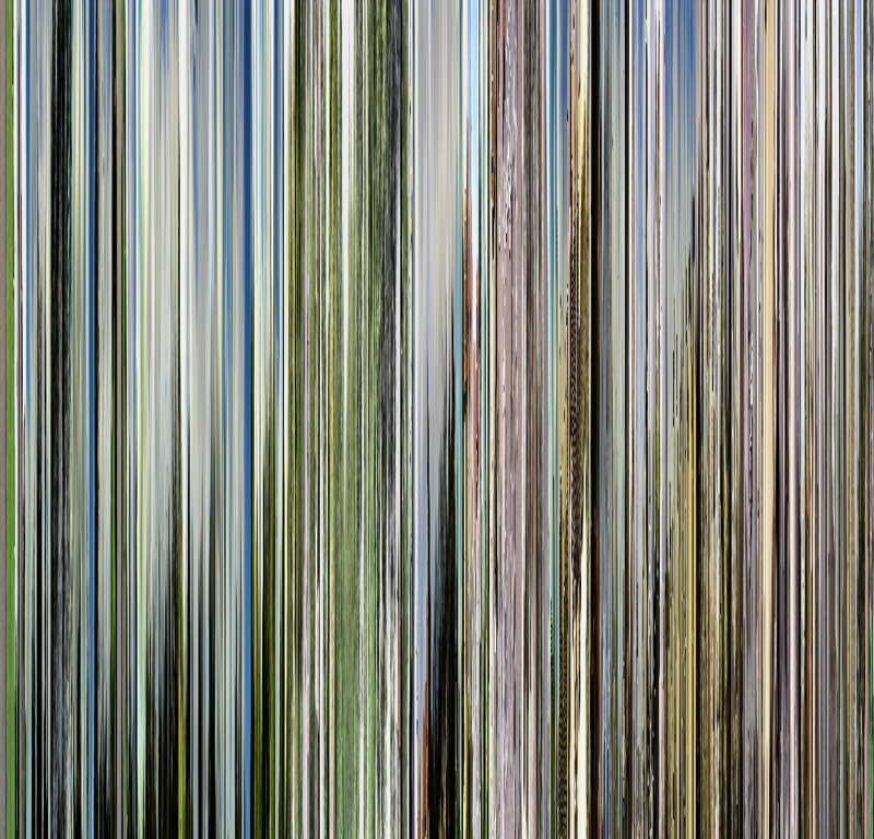
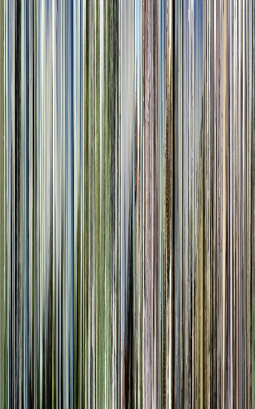
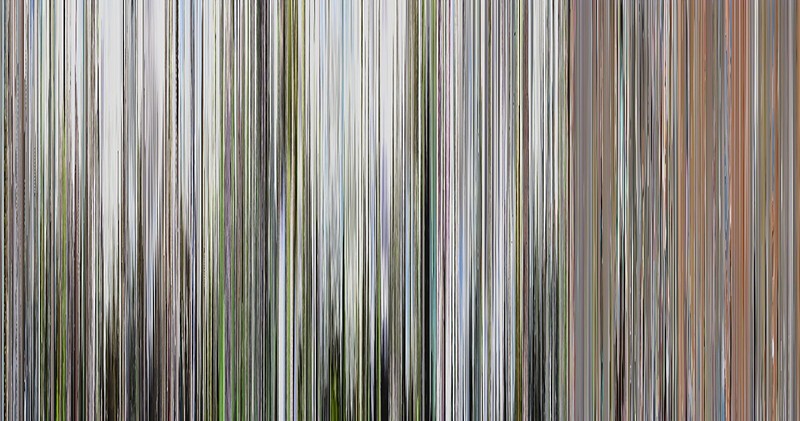
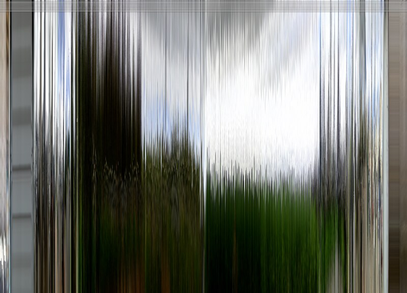
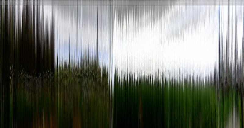
In the first attempt at assignment 6, I was working with the concept of the transition of light by recording a long sequence of a day within a static frame and then, frame slicing the videos and manipulating the frame slices to produce a barcode of the day. However, by the third visit and recording, the frame sliced barcodes were too similar to show defined differences. I posted the results in a previous post regarding Assignment 6.
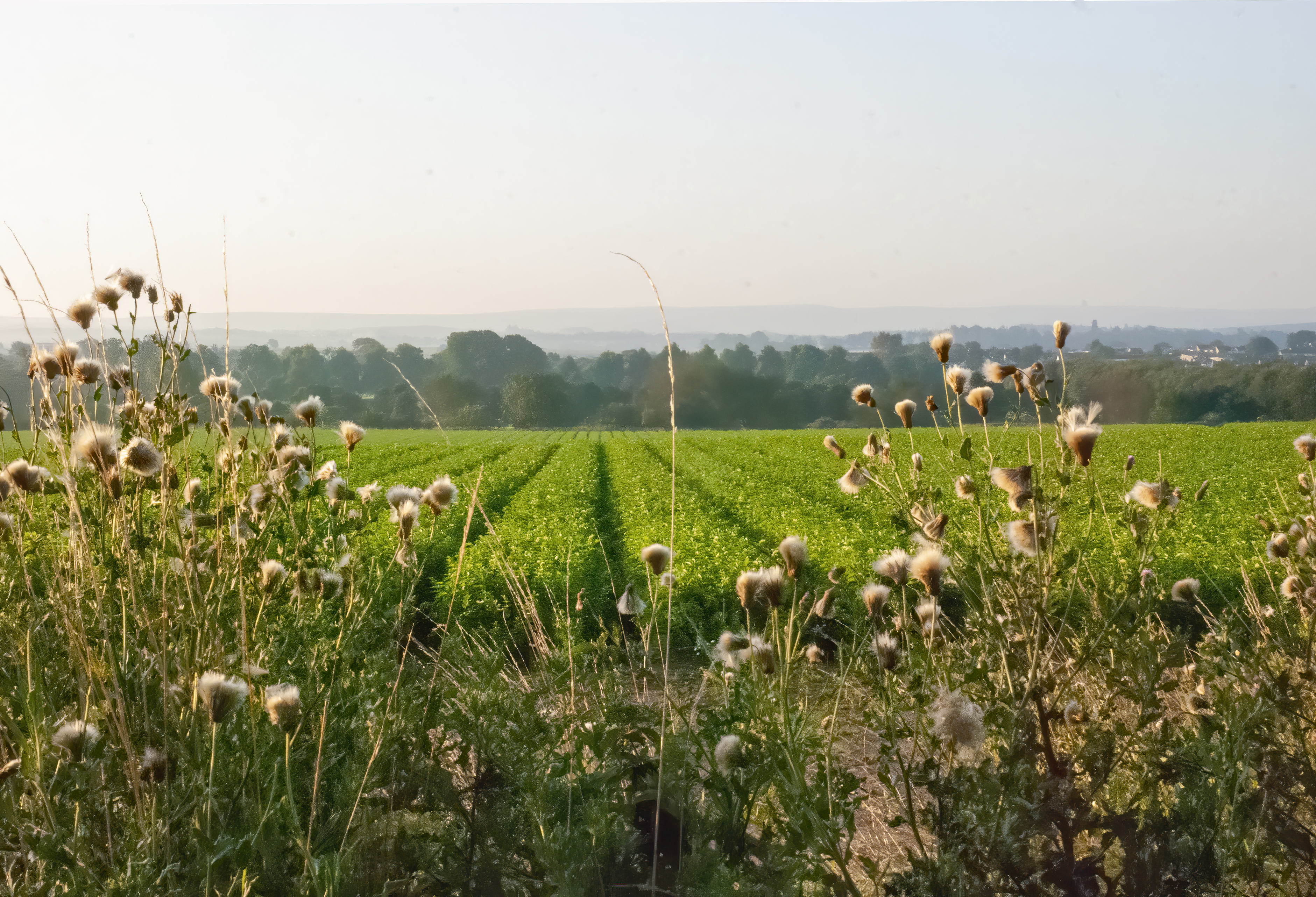
When this occurred I decided to step back and reassess the work, I then returned to a familiar location, which was easily accessible to me and even if I was having a poor day due to the effects of my condition, I would at least be able to get there and record the scene. This location is a south-facing field on the edge of the town, it looks down into the shallow valley before rising up into the Lammermuir’s.
I found a location which would be easily identified which was marked by a piece of broken fencing. Knowing that the likelihood of the fence undergoing repair was low, I was able to use that as a reference point for facing south. I was then able to align a tripod using the fenceposts as outer leg markers. I kept the lens movements to a minimum known that if I kept the lens to a certain position the images would be almost identical.
Process.
At first, I believed that I would be recording the changes to the landscape through the different seasons and lighting conditions, which would result in showing the landscape as it changed and evolved through the growth of the crops in the field and the differing effects of the seasons of the land.
While I have captured the different environmental and lighting conditions, I feel that the evolution of this part of the landscape is only really shown in the immediate foreground and the midground of the field. The rest of the scene contains a landscape which has remained largely unchanged since the iron age. The Lammermuir’s still contain evidence of an iron age fort and standing stones which predate the fort itself. While there is much evidence of an expansion into the greenbelt by towns and cities in East Lothian, here, the landscape has not changed since the 1950s; when a small housing scheme was built on the edge of the field. Since then the only real changes to the land have been the yearly agricultural cycle which creates a product for human consumption in one manner or another.
Certainly, there is a small evolution in the landscape as the season’s pass, the crops in the field grow and are then harvested, but outside of that, the landscape is largely unchanged. It has lain unchanged largely since the Iron Age, standing stones and forts still where they were placed at that time. The changes made on this part of the landscape are few and far between taking centuries to complete a change. Looking into the distance you see a land which is outside of time, for it has a sense of timelessness to it, no major highways cut through it and no industrial change has been placed on the land. It remains in pretty much the same state as it did over two thousand years ago.
The main foreground of the scene is a field whose change is only regulated by nature and the hand of man in the shape of the farmer, who manages the 3-mile long strip of land which rests between the river to the south and a public highway to the north. The dynamism of the field is driven solely by his demands, out with that, it is unchanged by the numerous walkers and cyclists who use the paths running along these borders.
This landscape, unlike other parts of the green belt, is not undergoing an evolution is use, it remains, open and for the majority visually unchanged and perceptually unmanaged. Other fields on the opposite side of time are undergoing a dynamic change; in that, they are evolving from places where food was grown into places where people inhabit, the modern, posher version of tact housing. Large parts of the green belt are being buried under housing developments as societal pressures drive the change in the landscape. Here however within these scenes, the system of the landscape is under no pressure and therefore does not need to evolve or change.
This can be seen in the following images, where apart from the direct changes created by use of the land by the farmer, in this case ploughing, seeding and growing of produce, that the only other changes are driven by nature; lighting conditions, environmental changes driven by the weather and the growth of grasses and weeds by nature.
The images have had a very small amount of post-processing, they have been processed in photoshop for horizon alignment and a small amount of sharpening and contrast. This was deliberate as the images are representative of land largely left alone as it the one piece of land in the area which is currently not under development for housing.
1. March 2018

Green field. A field which after being ploughed has been left fallow.
2. February 2019

Muddy Field – the field has now been ploughed.
3. April 2019

Dark Sky in the morning – The field has started to sprout.
4. May 2019

Mid Morning – Grows are green
5. August 2019
Mid Day – Weeds grow high in the immediate foreground
6. September 2019
Mid day – Weeds start to die.
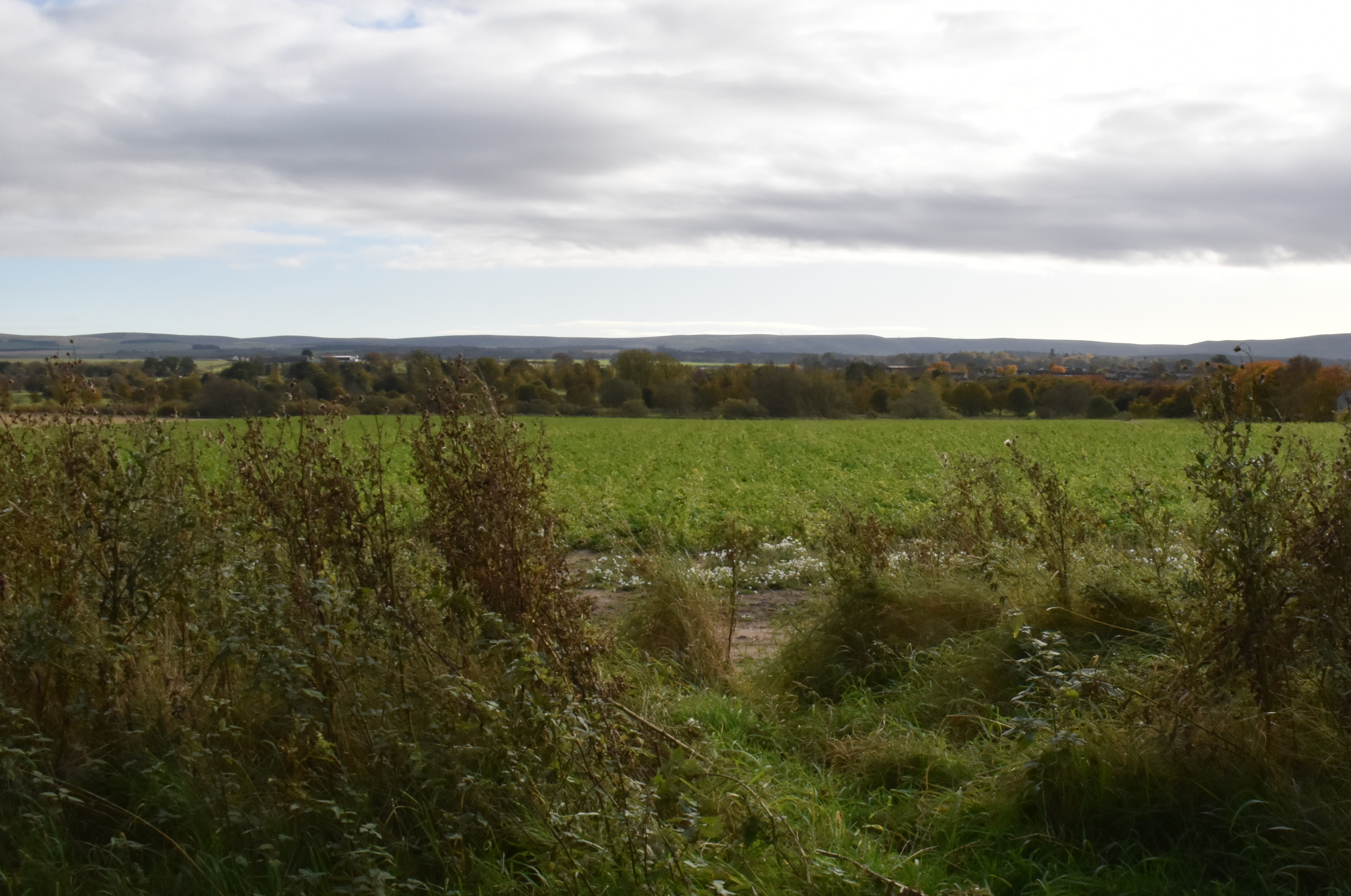
7. November 2019

Mid Day – Wet and wild weather has churned up mud, but we still await the harvest
It can be seen from these images that there is an element of placelessness within them. Similar to the images of Watkins and O’Sullivan (Briston, D. 2019), the landscapes are not defined territorially, nor geographically as a place (Sowers, J. 2019) rather, they are defined as a land of unknown elements and dangers. Here civilisation has stopped and is content to sit within the boundaries as created by the land itself. The Lammermuirs rising off into the distance uninviting and unwelcoming to man-made change. Much like sections of Yosemite, the land remains unchanged and under protection, although unlike Yosemite, the protection is done by the employees of the landowners, although there is some debate as to whether the land management is to the benefit of the wildlife.
Conclusion
While the land use overall in East Lothian is evolving and changing, the landscape, here, itself is unchanged to a major extent. The only real threat to the landscape is from humans as they continue to force the landscape to fit their shape, while at the main time ignoring the threats created by climate change. While this scene extends off into the peaceful distance, behind the camera, vehicles thunder along a major roadway almost constantly. In the air above, the main air corridor, where passengers and cargo are whisked high above the land. The land itself is acting as a soak for the carbon produced, but how long before the land is unable to manage the excesses of man and starts to die.
I am very happy with the work within the assignment, it has taught me to look at the landscape not a singular representation of beauty, but more of a changing system, some of which is under threat due to mankind. It has also taught me to review and revisit an area of interest to see how to light and seasons change the objectivity of the landscape.
References
Briston, D. (2019). The Evolution of American Landscape Photography Seen Through Imagery Made In Yosemite National Park. [online] Academia.edu. Available at: https://www.academia.edu/19519559/The_Evolution_of_American_Landscape_Photography_Seen_Through_Imagery_Made_In_Yosemite_National_Park?email_work_card=title [Accessed 26 Nov. 2019].
Edwards, R. (2014). Revealed: landowners massacre mountain hares in the Lammermuir Hills. [online] Rob Edwards. Available at: https://www.robedwards.com/2014/09/revealed-landowners-massacre-mountain-hares-in-the-lammermuir-hills.html [Accessed 26 Nov. 2019].
Raptor Persecution UK. (2017). Merlin population in decline on Lammermuir grouse moors. [online] Available at: https://raptorpersecutionscotland.wordpress.com/2017/03/06/merlin-population-in-decline-on-lammermuir-grouse-moors/ [Accessed 26 Nov. 2019].
Marzie Mohammadmiri (2019). Place In Photography: How Photographers Encounter Place. [online] European Journal of Media, Art and Photography. Available at: https://www.academia.edu/37910065/Place_In_Photography_How_Photographers_Encounter_Place [Accessed 26 Nov. 2019].
Seamon, D. (2015). Humanistic Geography–Lived Emplacement and the Locality of Being: A Return to Humanistic Geography? (2015). [online] Academia.edu. Available at: https://www.academia.edu/4935949/Humanistic_Geography–Lived_Emplacement_and_the_Locality_of_Being_A_Return_to_Humanistic_Geography_2015_?email_work_card=interaction_paper [Accessed 26 Nov. 2019].
Shinkle, E. (2019). Prelude to a Future: Globalisation and Risk in Contemporary Landscape Photography. [online] Academia.edu. Available at: https://www.academia.edu/8703297/Prelude_to_a_Future_Globalisation_and_Risk_in_Contemporary_Landscape_Photography?email_work_card=interaction_paper [Accessed 26 Nov. 2019].
Sowers, J. (2019). Place and Placelessness, Edward Relph. [online] Academia.edu. Available at: https://www.academia.edu/4446545/Place_and_Placelessness_Edward_Relph?email_work_card=interaction_paper [Accessed 27 Nov. 2019].